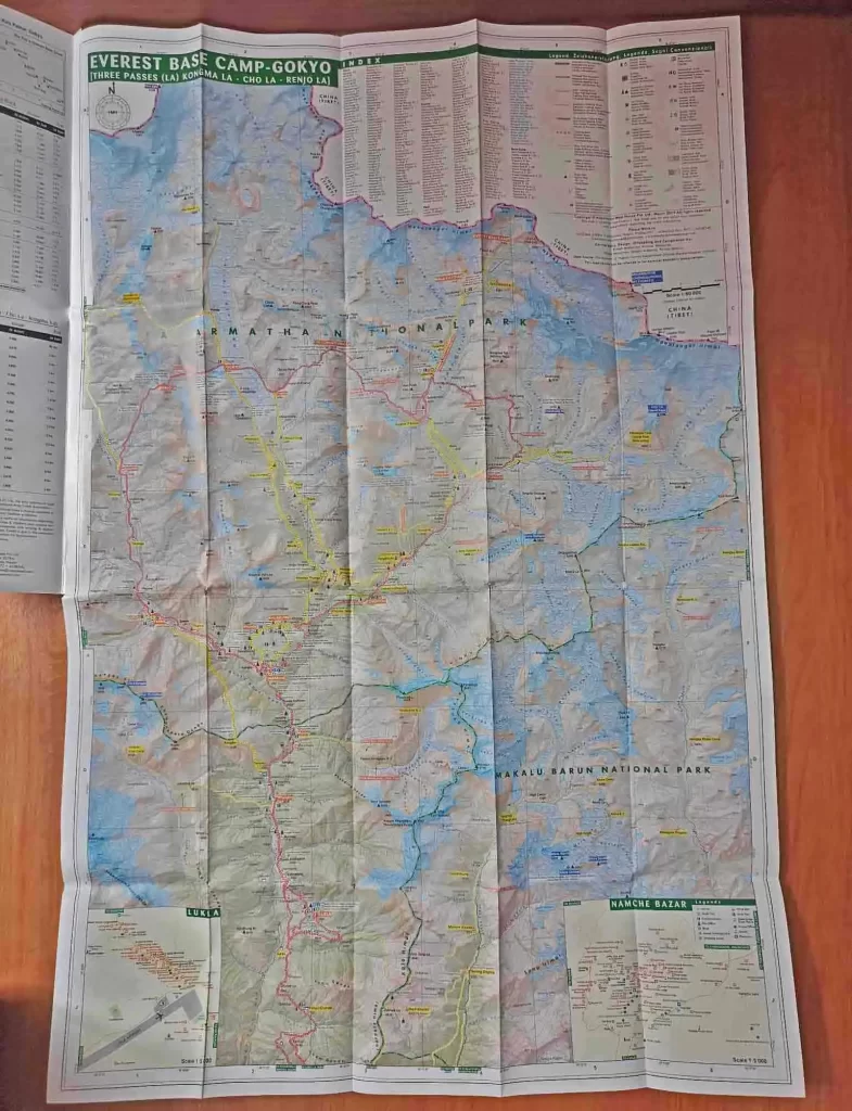
The Everest Base Camp Trek is a popular hiking trail that takes trekkers to the base of Mount Everest at an altitude of 5,364m. The trek is a challenging but rewarding experience that offers stunning views of the Himalayas, a chance to experience Sherpa culture, and an opportunity to push your limits. However, before embarking on this journey, it is essential to understand the importance of the Everest Base Camp Trek Map.
Why should you need Everest Base Camp Trek Map?
A map is a valuable tool for any trekker, and it is particularly important for the Everest Base Camp Trek. The trek covers a total distance of around 130km (that is 65km each way), and the terrain is rugged and ever-changing. Having a map will help you stay on track and avoid getting lost in the mountains. It will also help you plan your journey, decide on rest stops, and keep track of your progress.
A good Everest Base Camp Trek Map should be detailed and accurate, showing all the villages, landmarks, and natural features along the trail. It should also indicate the altitude at each point, so you can plan your ascent and descent accordingly. The map should also include information on the nearest medical facilities, rescue centers, and emergency contacts.

Where can I buy the Everest Base Camp Trek Map?
One option is to buy a guidebook that includes a detailed map of the trek. Guidebooks such as Lonely Planet’s “Trekking in the Nepal Himalaya” and “Trekking in the Everest Region” are popular choices. These guidebooks are available for purchase online or at bookstores.
Another option is to purchase the map separately from local trekking agencies in Nepal. Many of these agencies sell maps that are specific to the Everest Base Camp Trek and are up-to-date and accurate. You can find these agencies in the town of Lukla or in Kathmandu.
Types of Everest Base Camp Trek Map
Printed Maps – Printed maps are available in guidebooks or can be purchased separately. These maps provide a detailed overview of the trail and include information about the terrain, landmarks, and villages. They are usually made of durable and waterproof material, making them ideal for outdoor use.
Digital Maps – Digital maps can be downloaded and accessed through a smartphone or GPS device. They offer real-time navigation and can be customized to include additional information such as weather updates and altitude data. However, they may not be as detailed as printed maps and can be unreliable if the battery runs out.
Satellite Maps – Satellite maps provide a high-resolution view of the terrain and can be useful in identifying landmarks and trails. They are available online and can be accessed through Google Maps or other mapping software. However, they may not be suitable for use in the field as they can be difficult to read and may not include all the necessary information.

Detailed breakdown of the route map of Everest Base Camp Trek
It takes 12 days (most standard itinerary) to do the Everest Base Camp Trek. Hence, the route map of the Everest Base Camp Trek is divided into several stages, each covering a distance of around 8 – 10 km per day. Here is a detailed breakdown of the route map:
Stage 1: Lukla to Phakding – Distance: 7-8 km, Duration: 3-4 hours
Stage 2: Phakding to Namche Bazaar – Distance: 9-10 km, Duration: 5-7 hours
Stage 3: Namche Bazaar to Tengboche – Distance: 9-10 km, Duration: 5-6 hours
Stage 4: Tengboche to Dingboche – Distance: 10-11 km, Duration: 5-6 hours
Stage 5: Dingboche to Lobuche – Distance: 10 km, Duration: 5-6 hours
Stage 6: Lobuche to Gorak Shep to Everest Base Camp – Distance: 10 km, Duration: 8-9 hours (round trip)

Note: The distance and duration of each day’s trek depend on the stage and the altitude. As mentioned earlier, the trek covers around 6 – 10 km per day, with a duration of 4-9 hours, depending on the stage. It is crucial to plan your trek accordingly and take breaks to acclimatize and avoid altitude sickness.

